Fall Creek Mountain
Fall Creek Mountain is near the Grouse Ridge area just north of the Highway 80 & 20 junction, in Nevada
County, California. I hiked it with a friend, and took these pictures. See page bottom for excuses and denials.
All contents of this page are © 2003 by Richard Gorman.
To get there, take Highway 20 from Nevada City or Emigrant Gap, turn North on Forest Road 18 (Bowman Lake Road).
Drive 8.5 miles (there are good markers), to Forest Road 17 on the right. It's a rocky road, so take it easy, your
car will make it. Drive about 2.5 miles, staying to the right at the fork, to the Carr Lake trailhead. The trail
starts at the gate across the road. Carry plenty of water and sunscreen.
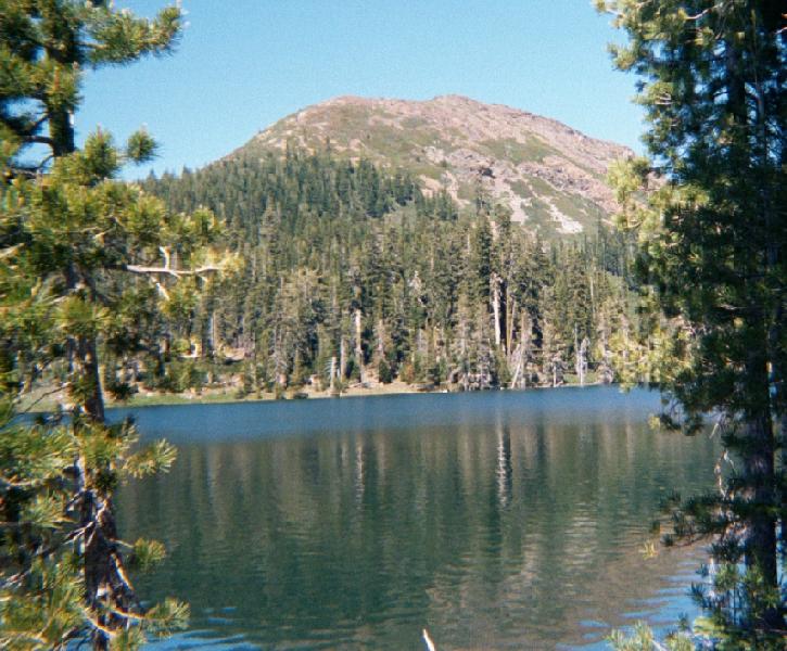
This is a picture of Fall Creek Mountain from across Feeley Lake. In mid-June, there was still snow on the ground,
and the wildflowers were just starting to get..
well
. Wild. My companion saw the view below, and decided we needed
to climb that... that being the face you see in the picture. We traversed the rocky parts, over a
lot of scree fields, on a short course to the top. We followed the Crooked Lakes Trail around the east end of Feely
Lake, and picked a line up the face. If you are looking for details on the hike, it went like this: We parked at
the aforementioned trailhead, it's an easy walk around Feely Lake, even when there's snow patches. It took maybe
two hours to the top. We ate a lot of food when we got there. After a rest and some pictures, we took the easy
way out, following the ridge to the east (right ) down to the top of Island Lake, and then back out -- maybe five
hours altogether.
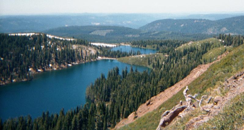
Part way up Fall Creek Mountain, Feely Lake is in the foreground with Carr Lake beyond, and were looking southwest.
Across the valley haze, that little bump on the horizon is probably Mount Diablo, just above and to the left of
that stunning clear-cut (above the snow patch).
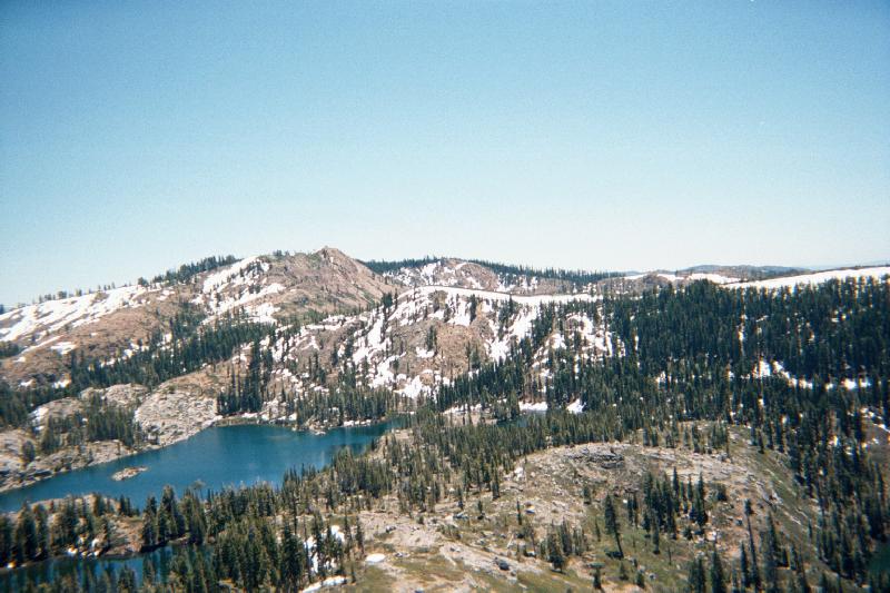
From the top of Fall Creek Mountain, looking southeast, Island Lake is in the foreground, over 600 feet below.
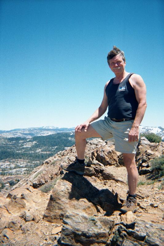
Its windy on top of the world. Looking east with the top of Fall Creek Mountain in the foreground, at 7498 feet.
To the left of my knee in the distance is Mount Lola, the highest point in the Tahoe National Forest.
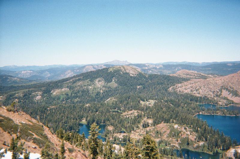
Turning now to the northwest, and my best picture from this journey. That volcano in the distance is Mount Lassen,
50 or 60 miles away. To the right along the horizon are the Cascades, and possibly even Mount Shasta. To the left
along the horizon is the Coast Range, and with the Sierra in the foreground, there are three mountain ranges in
this picture.
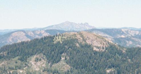 And just for fun, here is a full size
cut from the above picture, focusing on Mount Lassen. Lassen was visible from this area in a couple of other hikes
that I took to Sand Ridge, also in the Grouse Lakes proposed wilderness area. I was so inspired by these views
that I made a journey to Lassen Peak in September 2002, that you can read about too.
And just for fun, here is a full size
cut from the above picture, focusing on Mount Lassen. Lassen was visible from this area in a couple of other hikes
that I took to Sand Ridge, also in the Grouse Lakes proposed wilderness area. I was so inspired by these views
that I made a journey to Lassen Peak in September 2002, that you can read about too.
Excuses, Disclaimers, Denials, and Attributions:
These pictures were taken, mostly by Richard Gorman, with a disposable Kodak camera, developed to CD, and edited
with an old version of Lview Pro on a Win 95 system. Real high-tech. June 2002. Nevertheless, I would be really
flattered if you used any of my material.... but please stroke my ego, and give me credit, and tell me about it.
You can send me a message at: Richard J. Gorman